|
|
|
|
||
| Home Status MS-NFHL Contacts MGI Links | ||
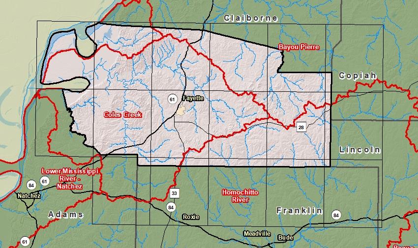
| Sub-Basin | % of County | Sq. Miles | |
|---|---|---|---|
| 1 | Coles Creek | 54.2% | 285.597 |
| 2 | Bayou Pierre | 20.5% | 107.929 |
| 3 | Homochitto River | 18.1% | 95.597 |
| 4 | Lower Mississippi River - Natchez | 7.2% | 37.961 |

County Seat: Fayette
Formed: 1799
Area: 527 square miles
Population: 7,599
Origin of County name: Named for Thomas Jefferson (first called "Pickering")