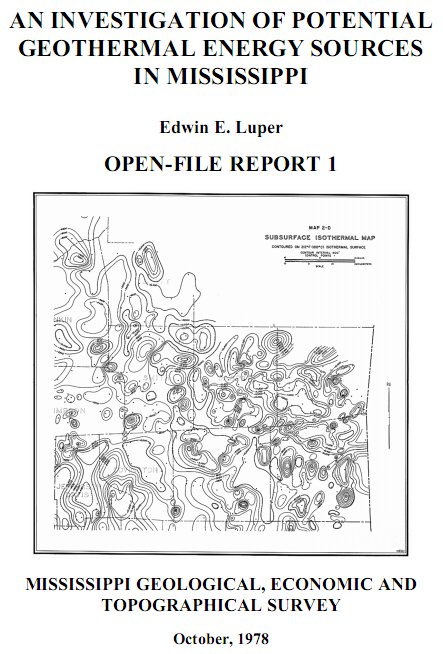
OPEN-FILE REPORT 1: An Investigation of Potential Geothermal Energy Sources in Mississippi
Edwin E. Luper, 1978, DOE Cont. No. EG-77-S-05-5361, 15 pages, 18 maps. Mississippi Geological, Economic and Topographical Survey, October 31, 1978 (MS Office of Geology: http://geology.deq.ms.gov).
Document Description
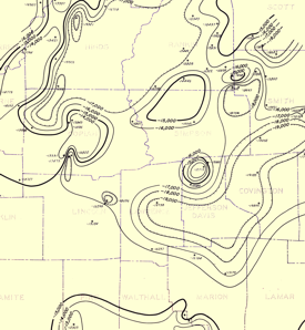
This report investigates the subsurface geotemperature regime of 40 counties of south and south-central Mississippi. Included in the report are 18 isothermal contour maps showing the subsea depths to the following temperatures: 158° F (70° C), 212° F (100° C), 248° F (120° C), 302° F (150° C), 356° F (180° C), 401° F (205° C). The isothermal maps are derived from bottom hole temperature (BHT) data collected from numerous oil and gas well log headers drilled in the study area prior to 1978.
This document is a scan of the original 1978 publication; it has not been updated.
Downloads
 OPEN-FILE REPORT 1: An Investigation of Potential Geothermal Energy Sources in Mississippi, with Maps
(PDF File Size: 19.3 MB)
(GIS download is the map image georectified)
| Title | Image | Zip |
| MAP 1-A - 158 Deg F (70 Deg C) Isotherm |
Image |
GIS (15.7 MB) |
| MAP 1-B - 158 Deg F (70 Deg C) Isotherm |
Image |
GIS (20.1 MB) |
| MAP 1-C - 158 Deg F (70 Deg C) Isotherm |
Image |
GIS (27.1 MB) |
| MAP 1-D - 158 Deg F (70 Deg C) Isotherm |
Image |
GIS (20.5 MB) |
| MAP 1-E - 158 Deg F (70 Deg C) Isotherm |
Image |
GIS (17.7 MB) |
| MAP 2-A - 212 Deg F (100 Deg C) Isotherm |
Image |
GIS (11.3 MB) |
| MAP 2-B - 212 Deg F (100 Deg C) Isotherm |
Image |
GIS (22.2 MB) |
| MAP 2-C - 212 Deg F (100 Deg C) Isotherm |
Image |
GIS (20.6 MB) |
| MAP 2-D - 212 Deg F (100 Deg C) Isotherm |
Image |
GIS (24.5 MB) |
| MAP 2-E - 212 Deg F (100 Deg C) Isotherm |
Image |
GIS (12.0 MB) |
| MAP 3-A - 248 Deg F (120 Deg C) Isotherm |
Image |
GIS (9.61 MB) |
| MAP 3-B - 248 Deg F (120 Deg C) Isotherm |
Image |
GIS (14.6 MB) |
| MAP 3-C - 248 Deg F (120 Deg C) Isotherm |
Image |
GIS (18.7 MB) |
| MAP 3-D - 248 Deg F (120 Deg C) Isotherm |
Image |
GIS (17.7 MB) |
| MAP 3-E - 248 Deg F (120 Deg C) Isotherm |
Image |
GIS (8.62 MB) |
| MAP 4 - 302 Deg F (150 Deg C) Isotherm |
Image |
GIS (16.2 MB) |
| MAP 5 - 356 Deg F (180 Deg C) Isotherm |
Image |
GIS (11.9 MB) |
| MAP 6 - 401 Deg F (205 Deg C) Isotherm |
Image |
GIS (8.58 MB) |


 Isotherm_Luper 1978.png)
 Isotherm_Luper 1978.png)
 Isotherm_Luper 1978.png)
 Isotherm_Luper 1978.png)
 Isotherm_Luper 1978.png)
 Isotherm_Luper 1978.png)
 Isotherm_Luper 1978.png)
 Isotherm_Luper 1978.png)
 Isotherm_Luper 1978.png)
 Isotherm_Luper 1978.png)
 Isotherm_Luper 1978.png)
 Isotherm_Luper 1978.png)
 Isotherm_Luper 1978.png)
 Isotherm_Luper 1978.png)
 Isotherm_Luper 1978.png)
 Isotherm_Luper 1978.png)
 Isotherm_Luper 1978.png)
 Isotherm_Luper 1978.png)