Environmental Geology - News
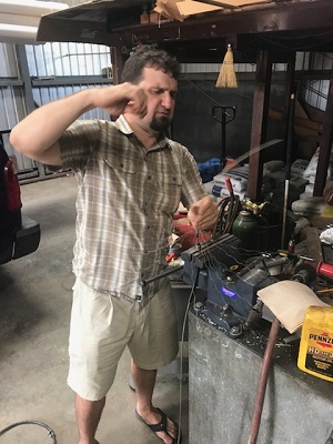
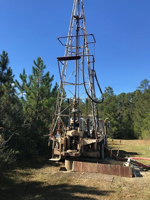
9/8/21 - Environmental Geology Division: Griner Drilling Service is pulling the casing of the Fairgrounds test well to began drilling of the production well. The driller of this well was the same driller of the first Baptist Hospital test well. In that well, the borehole was backfilled with sand in the annulus outside the casing all the way to the top of the hole. Also, a second test well was drilled before they came back to pull the casing on the first test well. As a result, the casing could not be pulled from the hole, even by a large crane pulling for 24 hours. This time the annulus was backfilled only to the top of the screen. The driller expects no problem here..
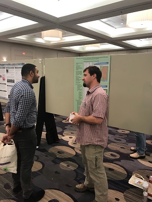
8/6/21 - Paul C. Parrish, RPG and Andrew Newcomb, RPG of the Environmental Geology Division presented "Analysis of Geophysical Log and Samples from F-0019 in Tishomingo County, MS" at the 85th Annual Meeting of the MS. Academy of Sciences.
2/13/20 - There are four upcoming presentations by the Environmental Geology Division. Andrew Newcomb, RPG will be presenting, "Mississippi Environmental Geology Website and Well Logging Intro", and Paul C. Parrish, RPG will be presenting "Hydrogeology of Mississippi." These presentations will be given on February 15, 2020 at the 9th Annual Mississippi Well Drillers Continuing Education Seminar hosted by Southwest Mississippi Community College. Also, Andrew Newcomb, RPG will be presenting, "3-D Mapping of Mississippi's Shallow Subsurface Through GIS Tools", and Paul C. Parrish, RPG will be presenting "Impacts on Awareness and Collections: Mississippi Office of Geology's Digital and Social Media Outreach." These two presentations will be given on February 21, 2020 in BIloxi, MS at the 84th Annual Meeting of the Mississippi Academy of Sciences.
2/13/20 - An update has been made to the links page. The new MDEQ website has been added and is the first link.
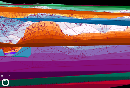
11/1/19 - Andrew Newcomb has plugged our subsurface geology data into a 3D modeling program with color-coded top-of-formation datum planes. From top to bottom, these plane are top of the Vicksburg Group (green), top of the Forest Hill For-mation (orange), top of the Yazoo Clay (blue), top of the Cockfield Formation (orange) and top of the Cook Mountain Formation (purple). In the images below, the software has taken us underground in eastern Rankin County near the top of the Cockfield. Looking west, we see the orange top of the Cockfield Formation rise, like a cumulus cloud through a stratified cloud deck, over the Jackson Dome at Jackson. Andrew will be presenting this work at the Mississippi Academy of Sciences in February of 2020. MDEQ’s Office of Geology will present five papers at that meeting.

10/24/19 - An update has been made to the borehole page, as well as the viewer. 46 new geophysical logs have been posted. All new logs run by the Environmental Geology Division will be in color.
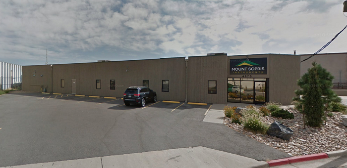
10/21/19 - Paul C. Parrish and Andrew Newcomb took the logging unit to Denver last week for servicing at Mt. Sopris Instruments. Everything has been tuned up to continue meeting logging needs for the Mississippi Office of Geology's data collection program.
2/28/19 - An update has been made to the borehole page, as well as the viewer. 12 new geophysical logs have been posted and 83 past logs have been colorized. The colorization is now complete for all of our raw data. All new logs run by the Environmental Geology Division will be in color.
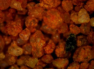
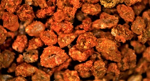
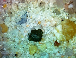
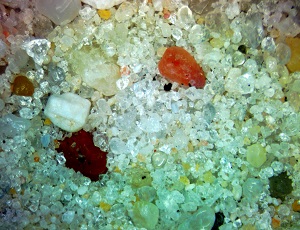
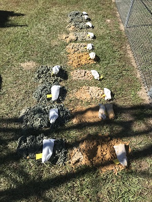
10/22/18 - Microscope shots of samples from this week's MDEQ submission for #microscopemonday on facebook, twitter, and instagram. Both pics show weathered Neshoba Sand of the Tallahatta Formation in the top 10ft of drill cuttings in Yalobusha County, MS.
10/22/18 - An update has been made to the borehole page, as well as the viewer. 8 new geophysical logs have been posted and 138 past logs have been colorized. The colorization is complete for our raw data through Sharkey County alphabetically.
8/30/18 - An update has been made to the borehole page, as well as the viewer. 2 new geophysical logs have been posted and 117 past logs have been colorized. The colorization is complete for our raw data through Lowndes County alphabetically.
8/10/18 - An update has been made to the borehole page, as well as the viewer. 7 new geophysical logs have been posted and 129 past logs have been colorized. The colorization is complete for our raw data through Kemper County alphabetically.
6/28/18 - An update has been made to the borehole page, as well as the viewer. 6 new geophysical logs have been posted and 124 past logs have been colorized. The colorization is complete for our raw data through Hinds County alphabetically.
6/14/18 - Microscope shots of samples from last week's drill hole in Jackson County to flesh out some stratigraphy for an open file report. Both pics show alluvium of the ancestral Pascagoula River within the Pamlico terrace.
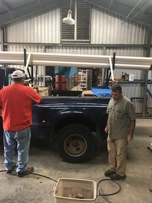
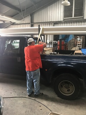
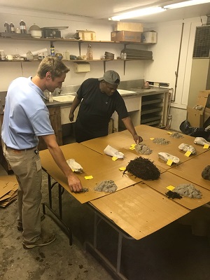
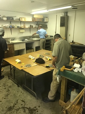
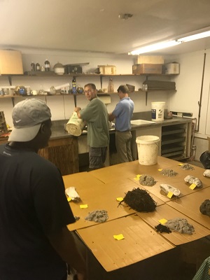
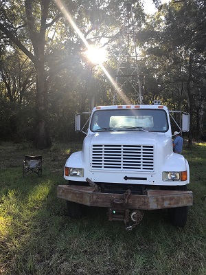
6/14/18 - The Environmental Geology Division had a busy day in the sample washing room and work bay today. Trey, Archie, and Jeremy were making preparations for the Delta drilling trip next week. Andrew and Paul were reheading the geophysical logging tool (must be done to keep moisture and dirt away from the working parts of the tool). Also, James Starnes and Jonathan Leard of the Surface Geology Division were washing and analyzing samples from the drilling project in Jackson County.
5/25/18 - An update has been made to the borehole page, as well as, the viewer. 6 new geophysical logs have been posted and 96 past logs have been colorized.
4/27/18 - An update has been made to the Links page. 2 new links have been posted. One is to the new MDEQ website and the other is to the youtube video of the MPB broadcast of "35 Million Years Down the Chickasawhay" which features the MS Office of Geology's own James Starnes
4/26/18 - An update has been made to the borehole page, as well as, the viewer. 2 new geophysical logs from recent drill sites have been added and 99 past logs have been colorized.
4/19/18 - The Environmental Geology Division and Surface Geolgy Division staff continue field reconnaissance for projects in Jefferson County, MS.
4/3/18 - An update has been made to the borehole page, as well as, the viewer. 16 new geophysical logs from recent drill sites have been added and 23 past logs have been colorized.
3/12/18-3/13/18 - The Environmental Geology Division's Andrew Newcomb and Paul C. Parrish attended the South-Central Section meeting of the Geological Society of America. They delivered a presentation on the role of the Mississippi Office of Geology and the Environmental Geology Division in Earthquake response and emergency management. They also presented a poster on the Environmental Geology Division's webpage and how it can be used in disaster response planning.
2/16/18 - The Environmental Geology Division's Paul C. Parrish was elected Chairman of the Geology and Geography Division of the Mississippi Academy of Sciences for 2018-2019. Dr. Jeremy Deans of the University of Southern Mississippi was elected vice chairman for the same term.
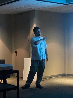
2/15/18-2/16/18 - The Environmental Geology Division's Andrew Newcomb and Paul C. Parrish attended the 82nd annual meeting of the Mississippi Academy of Sciences. They delivered a presentation on the realization, functions, and uses of the Environmental Geology Division's webpage. The presentation was well received by academia and may be used in future classroom instruction and projects.
1/31/18 and 2/14/18 - Tim Palmer, a researcher from Mississippi State University, visited the Environmental Geology Division to analyze several cores from South Mississippi. He is working on sequence stratigraphy along the Wiggins Arch. This work may become part of his doctoral dissertation. Mr. Palmer plans to return soon to continue his analysis.
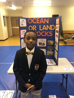
1/25/18 - Bralen Parker, grandson to Robert Ervin of the Environmental Geology Division, placed second in the New Hope science fair and will be going on to district competition with his geology based project.
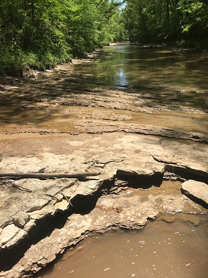
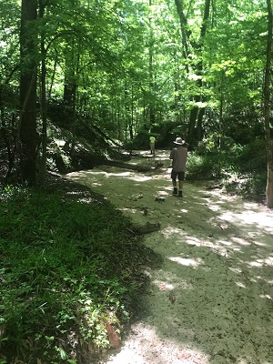
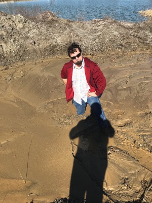
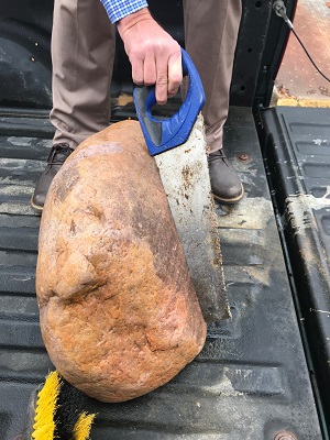
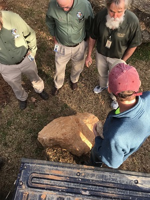
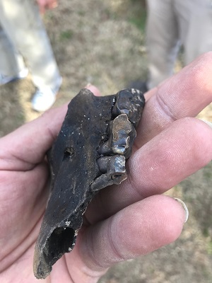
1/23/18 - The Environmental Geology Division's Paul C. Parrish and Andrew Newcomb participated in a field excursion with the Surface Geology Division's James Starnes. The purpose of the trip was to expose National Park Service geologists to local geology in the Vicksburg/Warren County area. The day included, as portrayed in the following pictures, safety lessons, geology, and paleontology. Andrew learned the dangers of walking where piping through loess is occurring. A 1+billion year old, glacially planed Sioux Quartzite boulder was discovered and delivered to the Mississippi Museum of Natural Science. A 500-600 lb. Ohio Valley Chert boulder was discovered and delivered to the museum. Also, Paul C. Parrish found a portion of a Pleistocene bear's upper mandible which was donated to the museum's collection. Thank you to Hammet Gravel, the Mississippi Museum of Natural Science, and the National Park Service.
11/13/17 - Please check out the MDEQ facebook, instagram, and twitter pages for the Environmental Geology Division's weekly contribution to the national hashtag, #microscopemonday. Drill samples, fossils out of the collection, and other interesting snapshots from our lab will be posted every Monday.
11/8/17 - An update has been made to the borehole page, as well as, the viewer. 170 e-logs dating back to 2011 have been colorized. This will be an ongoing effort with all of the e-logs for which there exists digital historical data. Also, new wells logged by the Environmental Geology Division since August 2017 have been added to the webpage. Water well contractors and other interested parties please give Andrew Newcomb a thank you if you see him on a logging trip for all of his hard work in this effort.
10/30/17-11/1/17 - The Environmental Geology Division's drill crew continued their work on the Jackson County StateMap project. A high, thin terrace was encountered followed by clays of the Pascagoula.
10/23/17-10/25/17 - Another successful drilling trip completed by the Environmental Geology Division's drill crew in support of Surface Geology's Jackson County StateMap grant project. This work will do much to further the understanding of the affects of changing sea levels during the Pleistocene on the Pascagoula Basin.
10/24/17 - The Environmental Geology Division hosted a researcher from Mississippi State University, and provided core samples from the ~210 million year old Eagle Mills Formation.
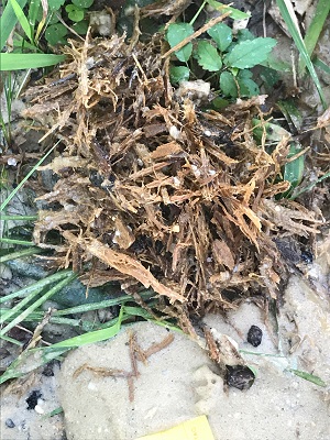
10/16/17-10/19/17 - In conjunction with the Surface Geology Division, the Environmental Geology Division's drilling crew was in Jackson County once again. Drilling for the Statemap 2017 project uncovered a surprise. A tree was encountered while drilling at a depth of 56 feet. The wood looked freshly buried, but could be ~100,000 years old.
9/26/17-9/28/17 - In conjunction with the Surface Geology Division, the Environmental Geology Division’s drilling crew was in Jackson County, MS drilling for the start of the 2017 StateMap project.
9/22/17 - In conjunction with the Surface Geology Division, the Environmental Geology Division had a day of outreach and fossil collecting at the Smith County lime pit with the paleontology class from the University of Southern Mississippi's Geology Department.