Project Status: DFIRM Effective 904.5 square miles
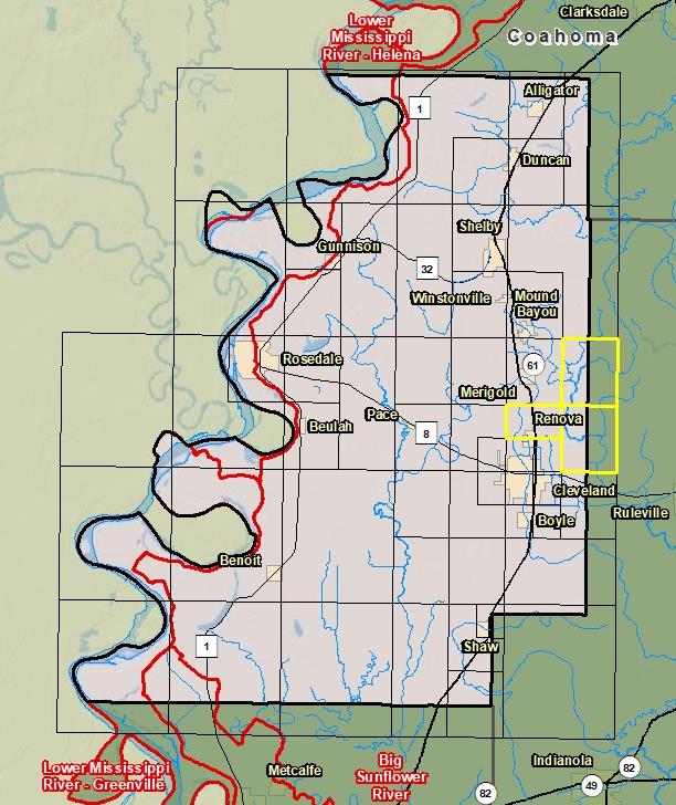
County Index Map
Changes since last FIRM
DFIRM Panels are provided as PDF documents.
Download a free PDF viewer.
Active Panels:
28011C0310E
28011C0315E
28011C0320E
Meetings
Discovery Meeting - Big Sunflower River - 08030207
Jul 9, 2013 - Cleveland, MS
Discovery Meeting - Deer Creek - Steele Bayou - 08030209
Jun 26, 2018 - Greenville, MS
Flood Risk Review - Big Sunflower River - 08030207
Jul 12, 2018 - Indianola, MS
Flood Risk Review - Big Sunflower River - 08030207
Jul 12, 2018 - Clarksdale, MS
Preliminary DFIRM Community Coordination (PDCC) - Big Sunflower River - 08030207
Jan 16, 2019 - Indianola, MS
Flood Risk Open House - Big Sunflower River - 08030207
Jan 16, 2019 - Indianola, MS
Preliminary DFIRM Community Coordination (PDCC) - Big Sunflower River - 08030207
Jan 17, 2019 - Clarksdale, MS
Flood Risk Open House - Big Sunflower River - 08030207
Jan 17, 2019 - Clarksdale, MS
Events
Discovery Report Published - Big Sunflower River- 08030207
May 1, 2014
Discovery Report Published - Deer-Steele Watershed - 08030209
Jan 11, 2019
Preliminary DFIRM and FIS Delivery
Nov 14, 2018
90 Day Community Appeal Period
Oct 9, 2019
- Jan 7, 2020
Letter of Final Determination
Sep 23, 2020
Study Effective Date
Mar 23, 2021
Documents
Discovery Report - Big Sunflower River - 08030207
May 1, 2014Discovery Report (10.3 MB)
Flood Insurance Study (Preliminary)
Nov 14, 2018Flood Insurance Study Vol 1 (7.67 MB)
Discovery Report - Deer-Steele Watershed - 08030209
Jan 11, 2019Discovery Report (1.94 MB)
County Seat: Cleveland and RosedaleFormed: 1836Area: 906 square milesPopulation: 33,768Origin of County name: Named for Simon Bolivar, South American hero.