|
|
|
|
||
| Home Status MS-NFHL Contacts MGI Links | ||
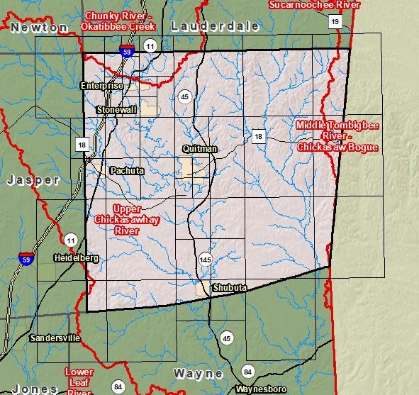
| Sub-Basin | % of County | Sq. Miles | |
|---|---|---|---|
| 1 | Upper Chickasawhay River | 93.0% | 643.983 |
| 2 | Chunky River - Okatibbee Creek | 3.5% | 24.515 |
| 3 | Middle Tombigbee River - Chickasaw Bogue | 3.3% | 23.007 |
| 4 | Lower Leaf River | 0.2% | 1.061 |

County Seat: Quitman
Formed: 1833
Area: 693 square miles
Population: 16,299
Origin of County name: Named for Judge Joshua Clarke, first Chancellor of the State of Mississippi.