|
|
|
|
||
| Home Status MS-NFHL Contacts MGI Links | ||
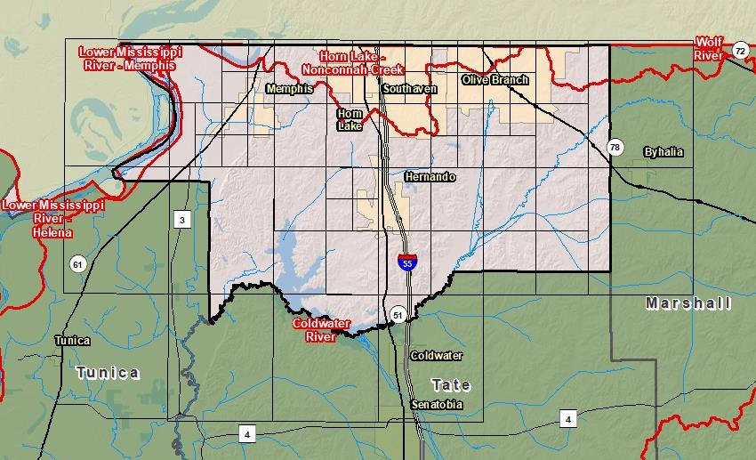
| Sub-Basin | % of County | Sq. Miles | |
|---|---|---|---|
| 1 | Coldwater River | 84.0% | 415.423 |
| 2 | Horn Lake - Nonconnah Creek | 13.9% | 68.580 |
| 3 | Lower Mississippi River - Helena | 1.1% | 5.445 |
| 4 | Lower Mississippi River - Memphis | 1.1% | 5.254 |

County Seat: Hernando
Formed: 1836
Area: 497 square miles
Population: 170,913
Origin of County name: Named for Hernando DeSoto, discoverer of the Mississippi River.