|
|
|
|
||
| Home Status MS-NFHL Contacts MGI Links | ||
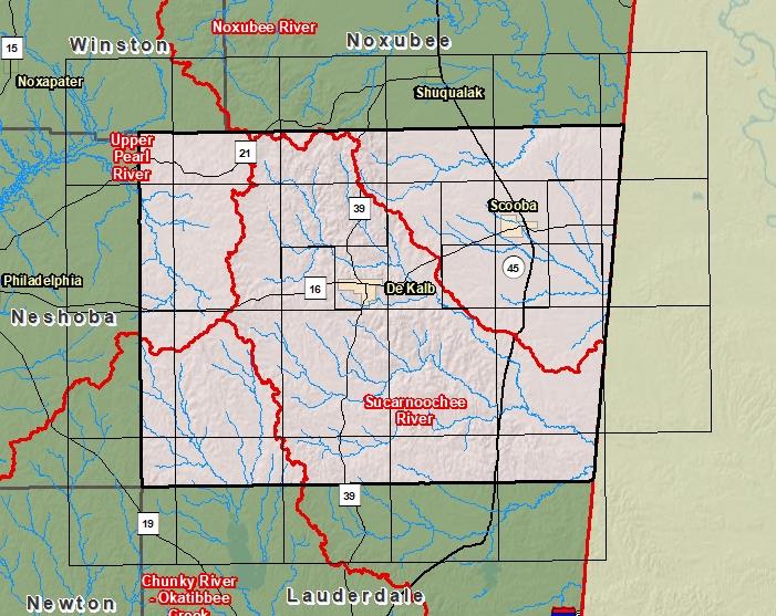
| Sub-Basin | % of County | Sq. Miles | |
|---|---|---|---|
| 1 | Sucarnoochee River | 48.2% | 368.981 |
| 2 | Noxubee River | 27.4% | 210.117 |
| 3 | Upper Pearl River | 12.4% | 94.828 |
| 4 | Chunky River - Okatibbee Creek | 12.0% | 91.696 |

County Seat: DeKalb
Formed: 1833
Area: 767 square miles
Population: 10,163
Origin of County name: Named for Reuben Kemper, who led a company of men from the Mississippi Territory against Spanish Mobile in 1811.