|
|
|
|
||
| Home Status MS-NFHL Contacts MGI Links | ||
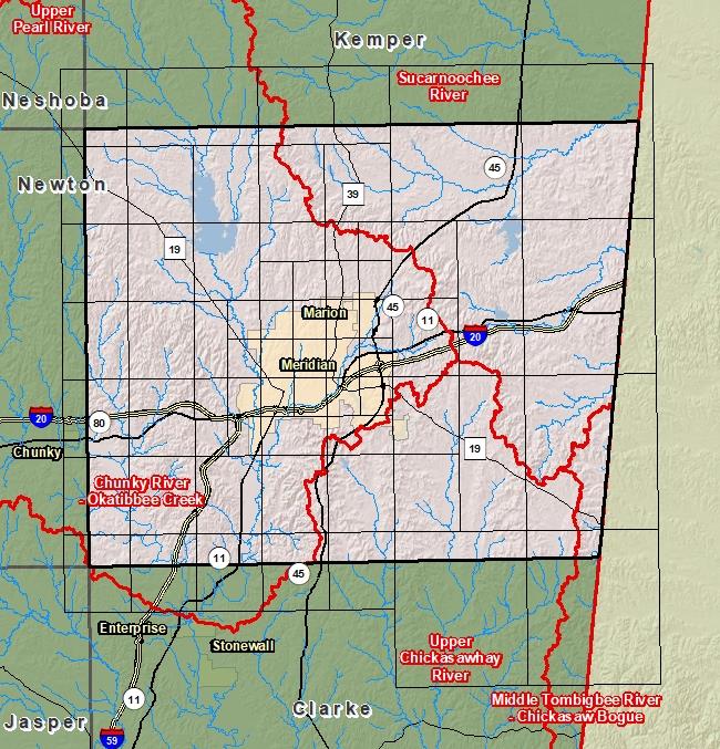
| Sub-Basin | % of County | Sq. Miles | |
|---|---|---|---|
| 1 | Chunky River - Okatibbee Creek | 51.6% | 368.573 |
| 2 | Sucarnoochee River | 31.0% | 221.571 |
| 3 | Upper Chickasawhay River | 15.7% | 111.903 |
| 4 | Middle Tombigbee River - Chickasaw Bogue | 1.7% | 12.309 |

County Seat: Meridian
Formed: 1833
Area: 715 square miles
Population: 79,739
Origin of County name: Named for Colonel James Lauderdale, who fought in the Battle of New Orleans.