Project Status: Review Phase
County approx. 805.0 square miles
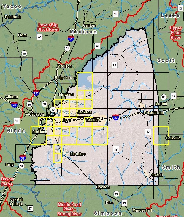
County Index Map
 Changes since last FIRM
DFIRM Panels are provided as PDF documents.
Download a free PDF viewer.

Active Panels:
Meetings
-
Discovery Meeting - Middle Pearl-Strong River - 03180002
Jun 26, 2012 - Jackson, MS
-
Flood Risk Review -Middle Pearl-Strong River - 03180002
Jan 9, 2017 - Pearl, MS
-
Pearson Levee Analysis and Mapping Procedure (LAMP) Stakeholder Engagement Meeting
Nov 2, 2017 - Pearl, MS
-
Pearson Local Levee Partnership Team Meeting
Jan 13, 2018 - Pearl, MS
-
Preliminary DFIRM Community Coordination (PDCC) - Middle Pearl-Strong River - 03180002
Apr 10, 2018 - Pearl, MS
-
Flood Risk Open House Middle Pearl-Strong River - 03180002
Apr 10, 2018 - Pearl, MS
-
Pearson Local Levee Partnership Team Meeting
Sep 11, 2018 - Pearl, MS
-
Pearson Local Levee Partnership Team LAMP Flood Risk Review Meeting
Dec 17, 2019 - Pearl, MS
Events
-
Discovery Report Published - Middle Pearl-Strong River - 03180002
Jul 26, 2013
-
Preliminary DFIRM and FIS Delivery - Middle Pearl-Strong River
Feb 9, 2018
-
Revised Preliminary DFIRM and FIS Delivery - Middle Pearl-Strong River - Rankin County
Nov 18, 2020
-
90 Day Community Appeal Period - Middle Pearl-Strong River
Aug 8, 2019
- Nov 6, 2019
-
90 Day Community Appeal Period - Middle Pearl-Strong River - Revised Rankin County
To Be Determined
-
Letter of Final Determination - Middle Pearl-Strong River - Revised Rankin County
To Be Determined
-
Study Effective Date - Middle Pearl-Strong River - Revised Rankin County
To Be Determined
-
Levee Analysis and Mapping Plan Published - Pearson Levee - City of Pearl
Aug 31, 2018
-
Preliminary DFIRM and FIS Delivery - Pearson Levee - City of Pearl
Apr 28, 2020
Documents
-
Discovery Report - Middle Pearl-Strong - 03180002
Jul 26, 2013
Discovery Report (1.34 MB)
-
Levee Analysis and Mapping Plan - Pearson Levee LAMP Project - City of Pearl
Aug 31, 2018
Levee Analysis and Mapping Plan (10.1 MB)
-
Flood Insurance Study (Preliminary)
Nov 18, 2020
Flood Insurance Study Vol 1 (1.29 MB)
Flood Insurance Study Vol 2 (3.97 MB)
Flood Insurance Study Vol 3 (5.64 MB)
County Seat: Brandon
Formed: 1828
Area: 806 square miles
Population: 148,070
Origin of County name: Named for Chistopher Rankin, U.S. Representative.