|
|
|
|
||
| Home Status MS-NFHL Contacts MGI Links | ||
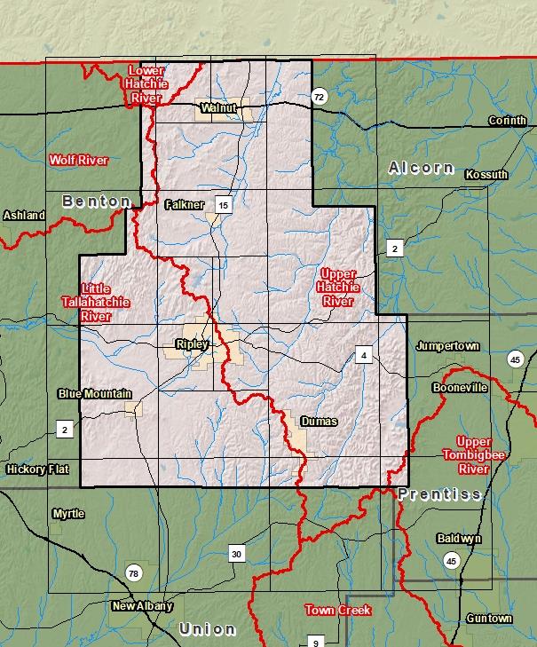
| Sub-Basin | % of County | Sq. Miles | |
|---|---|---|---|
| 1 | Upper Hatchie River | 62.6% | 287.655 |
| 2 | Little Tallahatchie River | 34.0% | 156.074 |
| 3 | Lower Hatchie River | 1.8% | 8.434 |
| 4 | Wolf River | 1.2% | 5.367 |
| 5 | Upper Tombigbee River | 0.4% | 1.668 |

County Seat: Ripley
Formed: 1836
Area: 460 square miles
Population: 22,039
Origin of County name: Named for Indian word meaning "cut off".