|
|
|
|
||
| Home Status MS-NFHL Contacts MGI Links | ||
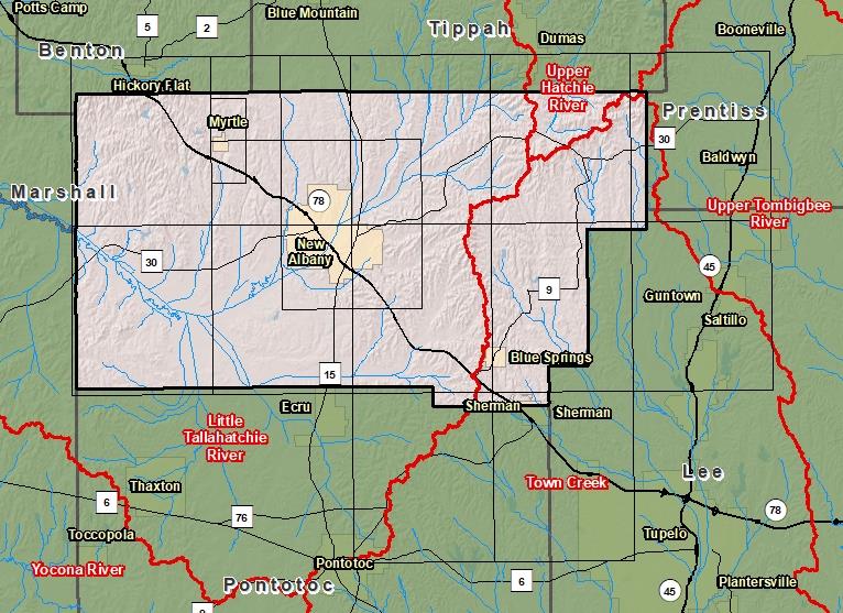
| Sub-Basin | % of County | Sq. Miles | |
|---|---|---|---|
| 1 | Little Tallahatchie River | 77.8% | 323.936 |
| 2 | Town Creek | 19.6% | 81.452 |
| 3 | Upper Hatchie River | 2.6% | 10.991 |
| 4 | Upper Tombigbee River | 0.0% | 0.078 |

County Seat: New Albany
Formed: 1870
Area: 417 square miles
Population: 28,097
Origin of County name: Named for the nickname of the United States.