FY2009Lee County
Fiscal Year:
2009
Project Type:
Unmet Mapping Needs
Status:
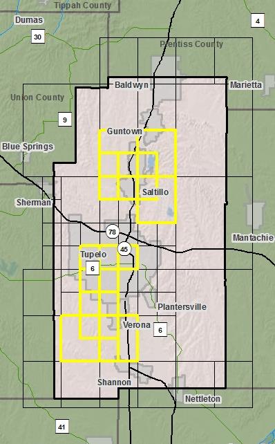
DFIRM EffectiveYou can access DFIRM data and maps at FEMA's Map Service Center (MSC)  County Index Map
Flood Insurance Study
County Index Map
Flood Insurance Study
 Note: Panel and map PDF files can be large, up to 75mb.
Meetings
- Scoping Meeting :
Sep 18, 2009 - 11:00 AM
- Final Community Officials Meeting :
Jul 18, 2012 - 3:00 PM
- Open House Meeting :
Jul 18, 2012 - 5:00 PM
Events
- 90 Day Community Appeal
Start Date: Oct 05, 2012
End Date: Jan 03, 2013- Preliminary DFIRM and FIS delivery:
May 04, 2012- Letter of Final Determination:
Apr 16, 2013- Study Effective Date:
Oct 16, 2013Documents
No Documents Available
County Seat: Tupelo
Formed: 1866
Area: 453 square miles
Population: 75,755
Origin of County name: Named for Robert E. Lee, General of the Confederacy.