![[Company Logo Image]](images/bannerdeq.jpg)
Historic Shorelines
|
Historic Shorelines |
|
|
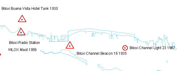
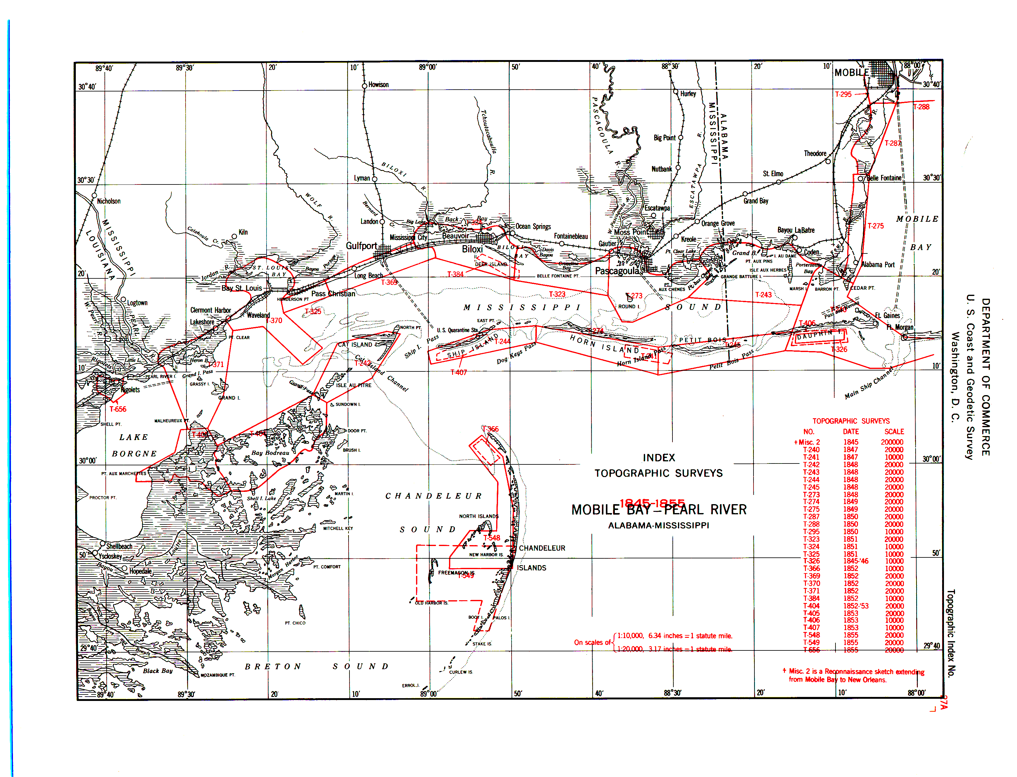
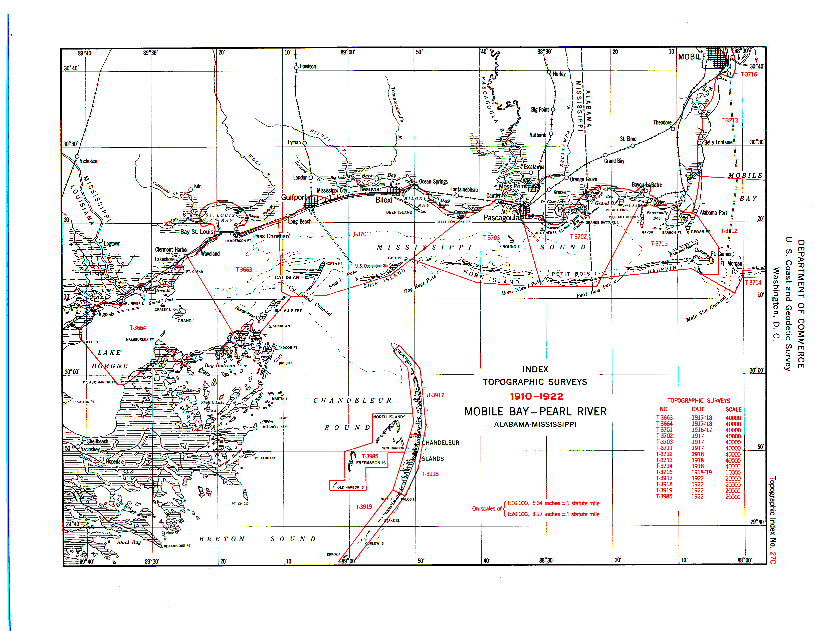
The 1850, 1917, 1950, 1966, and 1971 shorelines and man made features were digitized from US Coast and Geodetic t-sheets. The 1986 shorelines and man made features were digitized from aerial photography. The scale and exact year of the t-sheet vary. Map-specific metadata is in the t_###.sid.xml file. See the following Index Maps for of T-sheet ID's, locations, scale, and dates. 1845-1855, 1856-1909, 1910-1922, 1930-1952West, 1930-1957East, 1966-1971West, 1966-1971East. Download Shorelines - All are zipped shapefiles except for controlanno.zip, which contains .e00.
mscontrolpts.zip - control points, arcs (triangles and circles), and annotation found only in an Arc export interchange file (.e00)
|
|
Send mail to
Webmaster
with questions or comments about this web site. |

