|
| |
T-sheets have been
scanned and geo-rectified in (MSTM)
projection using previously digitized historic shorelines from
the same maps. Geo-rectification adds some error to the absolute accuracy
of the maps. Each map has a
different RMS (root mean squared) accuracy so please check
Metadata for
accuracy of each individual map. Map-specific metadata is in the
t_###.sid.xml file. T-sheets for portions of Louisiana and Alabama have also
been scanned, but not rectified. To get these maps go to
Historic Maps - Other
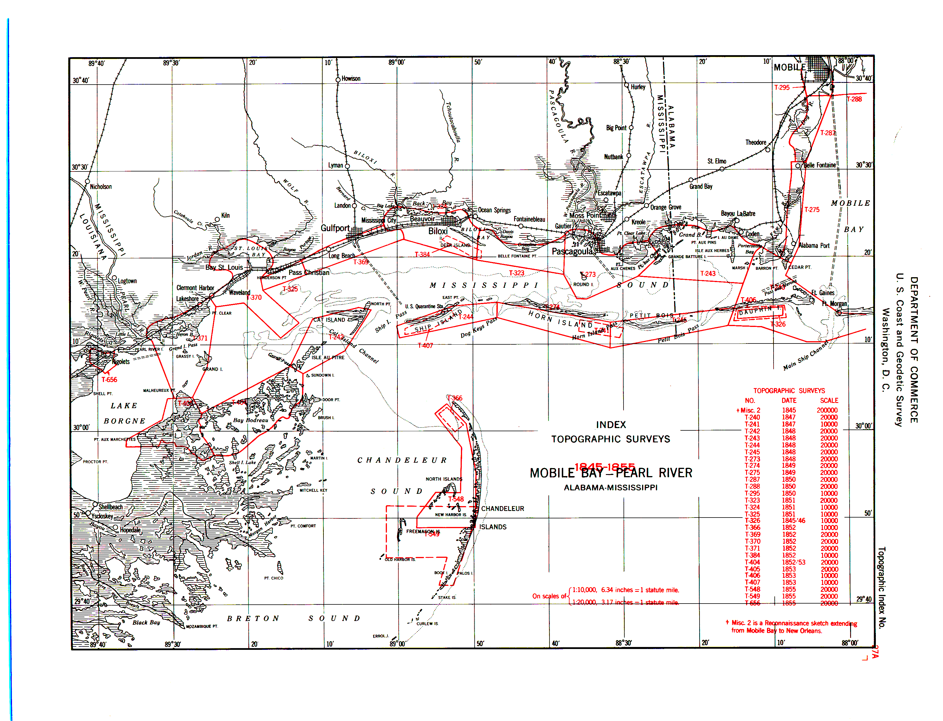
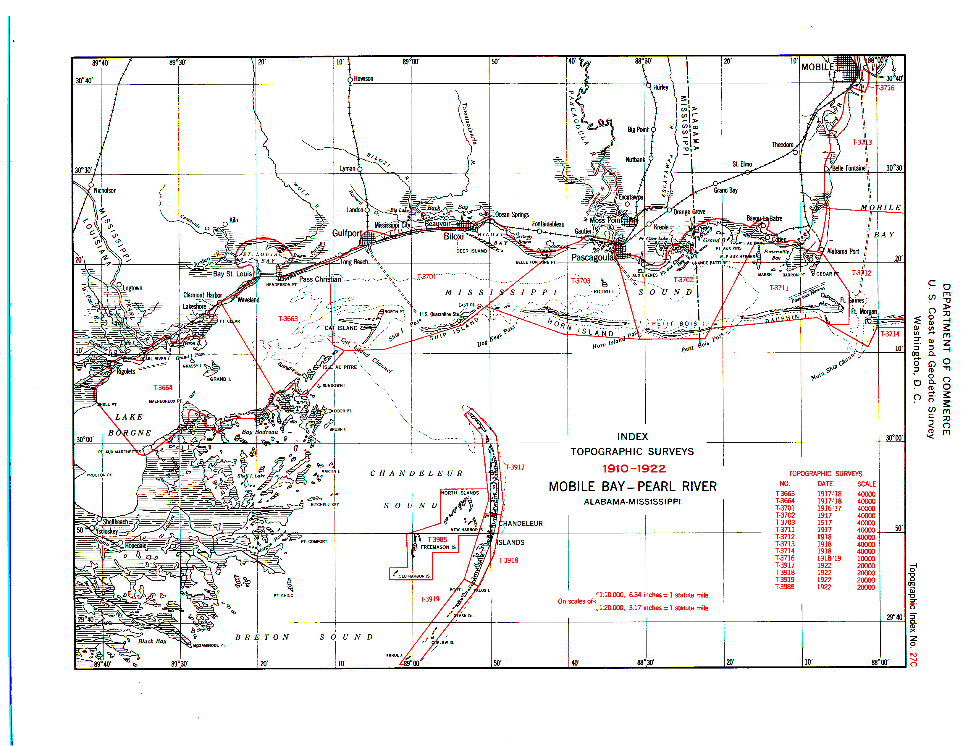
See the following Index Maps
for of T-sheet ID's, locations, scale, and dates.
1845-1855,
1856-1909,
1910-1922
DOWNLOAD T-SHEETS
|
![[Company Logo Image]](images/bannerdeq.jpg)