FY2009Rankin County
Fiscal Year:
2009
Project Type:
County Remap
Status:
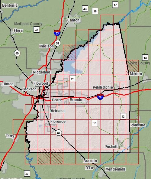
DFIRM EffectiveYou can access DFIRM data and maps at FEMA's Map Service Center (MSC)  County Index Map
Flood Insurance Study
County Index Map
Flood Insurance Study
 Note: Panel and map PDF files can be large, up to 75mb.
Meetings
- Scoping Meeting :
Sep 14, 2009 - 2:00 PM
- Final Community Officials Meeting :
Jun 13, 2012 - 3:00 PM
- Open House Meeting :
Jun 13, 2012 - 5:00 PM
Events
- 90 Day Community Appeal
Start Date: Jan 30, 2013
End Date: Apr 30, 2013- Preliminary DFIRM and FIS delivery:
May 04, 2012- Letter of Final Determination:
Dec 09, 2013- Study Effective Date:
Jun 09, 2014Documents
No Documents Available
County Seat: Brandon
Formed: 1828
Area: 806 square miles
Population: 115,327
Origin of County name: Named for Chistopher Rankin, U.S. Representative.