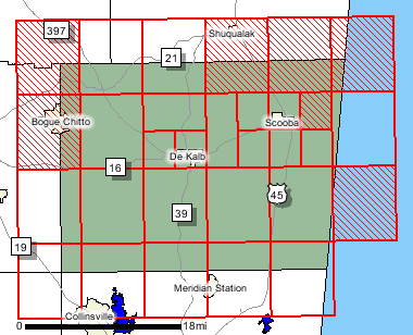
Map ModKemper County
FEMA DFIRM Funding Year:FY2003
Status:
DFIRM EffectiveYou can access DFIRM data and maps at FEMA's Map Service Center (MSC)  County Index Map
Flood Insurance StudyPreliminary DFIRM Panels
County Index Map
Flood Insurance StudyPreliminary DFIRM Panels (23)
 Note: Panel and map PDF files can be large, up to 75mb.
Meetings
Meet and Greet :
5/5/2004 Scoping Meeting :
7/28/2004 Scoping Meeting Follow-Up :
Final Community Officials Meeting :
8/1/2006 "Flood Map Open House" Meeting :
8/1/2006 Events and Documents
Proposed Studies Scoping Map Preliminary DFIRM and FIS delivery :
6/29/200690 Day Community Appeal Start Date :
9/15/200690 Day Community Appeal End Date :
12/14/2006Letter of Final Determination Date :
3/5/2007Study Effective Date :
9/5/2007
County Seat: DeKalb
Formed: 1833
Area: 767 square miles
Population: 10,453
Origin of County name: Named for Reuben Kemper, who led a company of men from the Mississippi Territory against Spanish Mobile in 1811.